Publisher
Daily Record
Blurb
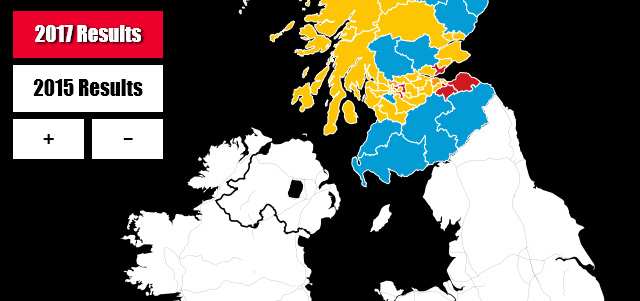
SNP big guns Alex Salmond and Angus Robertson were ousted by Tories in a shock general election result, which was in stark contrast to the outcome in 2015.
I created this responsive interactive map to show readers how the election results were distributed across the UK and updated it live during the event. It was made using CARTO’s map API, GIS and Leaflet. I filtered the data using SQL, and built the core graphic with HTML, CSS, JavaScript and jQuery.
Read more: http://www.dailyrecord.co.uk/news/politics/general-election-2017-interactive-map-10589708
My role
- Data collection
- Data wrangling
- Designer
- Developer
Tools
- Brackets
- CartoDB API
- GIS
- Leaflet
- Microsoft Excel